
Joshimath RED ALERT: List of Canceled Treks and Other Related Updates
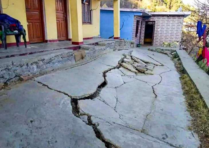
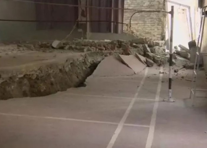
Joshimath, the entry point to Hemkund Sahib and Badrinath, has been designated a landslide-subsidence zone. The “sinking” Joshimath continued to be evacuated on Saturday as more homes developed cracks.
Till now, more than 600 other buildings have started to develop cracks. The town’s residents have decided to stay outside while braving the winter weather. The state government has announced a relief fund of INR 11 crore saying that keeping the affected people safe is its first concern.
The authorities have also had a difficult time since Joshimath is sinking. Nearly 70 affected families have been relocated, and efforts to evacuate many more are under progress.
1. Location , Topography, & Extreme Weather Events
The town is situated in a region that is vulnerable to landslides, according to a study by the Uttarakhand State Disaster Management Authority (USDMA), and the first incident of subsidence in it was described in a 1976 Mishra Commission report.
According to Piyoosh Rautela, Executive director USDMA, “The area around Joshimath town is covered with a thick layer of overburden material. Large boulders of rocks are embedded in grey-coloured, silty-sandy matrix, making the town highly vulnerable to sinking.”
According to the USDMA study, the region is vulnerable to landslides because of the area’s perennial streams, significant amounts of snow in the upper reaches, and severely worn gneissic rocks with weak cohesive properties.
With toe erosion and sliding along Ravigram Nala and the Nau Ganga Nala having worsened since the February 7, 2021, flooding of Rishi Ganga, the report stated that flood events in June 2013 and February 2021 had a negative influence on the landslide zone.
On October 17, 2021, Joshimath experienced 190 mm of rainfall in 24 hours, significantly weakening the landslide zone.
“Deep toe erosion along the left bank of the Alaknanda, downstream of its confluence with the Dhauliganga river at Vishnuprayag, has also been exacerbated by the massive volume of debris-laden water pushed down by the Dhauliganga during a recent flood episode (February 2021). The slope on which Joshimath town is located was negatively harmed as a result, according to the USDMA assessment.
2. Geology
The study also made note of how the Joshimath region is particularly susceptible to sinking due to eco-tectonic, geomorphic, and climatic elements combined. Joshimath is located in the Chamoli area, which is in Seismic Zone V, and has seen a number of earthquakes with magnitudes under 5 on the Richter scale.
According to an anonymous geological institute scientist from Dehradun, “Joshimath is extremely vulnerable to sinking due to tectonic activity because it sits on a fault line and close to two other ones.”
According to experts, the “earth tectonic activity” underneath may cause more landslides. In 1976, the Mishra Commission report—headed by MC Mishra, who was at the time Uttar Pradesh’s top bureaucrat—recommended against significant construction in the vicinity of Joshimath.
3. Unplanned Construction
The project’s head race tunnel runs entirely through the geologically sensitive region below Joshimath. The tunnel was dug out using a tunnel boring machine (TBM). On December 24, 2009, it pierced a strata containing water three kilometers inside the left bank of the Alaknanda, close to the settlement of Shelong. The conditions happening today were warned by the experts, 10 years ago. It is not unexpected that the town is sinking because no corrective action was done, he said.
According to the USDMA survey report from August 2022, unplanned development without consideration for bearing capacity has exacerbated slope instability-related issues in Joshimath.
4. Improper Water Drainage
As highlighted by experts and the USDMA, because of anthropogenic surface-level activity, natural water drainage channels have been hindered. Thus, forcing water to seek alternative drainage pathways. Secondly, Joshimath has no proper sewage system.
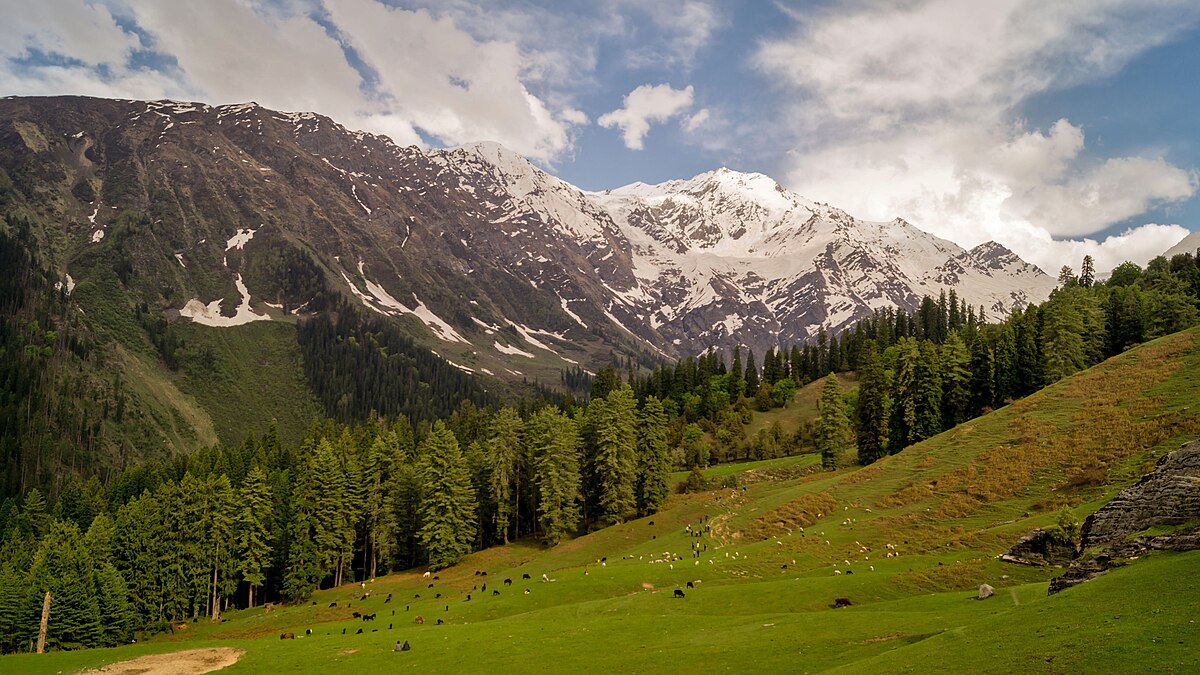
LIST OF ALL CANCELED TREKS & TOURS
- Kuari Pass Trek
- Pangarchulla Trek
- Valley of Flowers Trek
- Badrinath Trek
- Kedarnath Trek
- Khulagarbiya Pass Trek
- Saptrishi Pass trek
- Bhyundar Khal Trek
- Auli Tour
- Auli Chopta Tour
RELIEF & RESCUE OPERATIONS INTENSIFIED
Operations for relief and rescue were intensified in Joshimath after the alert. In a statement released on Sunday, the Center emphasized that human safety was the first priority right away and asked specialists to draft short- and long-term plans for conservation and recovery.
WHAT EXPERTS SAY ON JOSHIMATH LAND SUBSIDENCE
According to Professor Yashpal Sundriyal of the Geology Department at Hemwati Nandan Bahuguna University, Joshimath was on the verge of collapse due to the excessive development boom and drainage issues.
According to Ramesh Pokhriyal Nishank, a former chief minister of Uttarakhand, there is no need for large-scale projects in the hill state because it is a sensitive area.
For further investigations, a group of specialists from the National Disaster Management Authority (NDMA), Geological Survey of India, National Institute of Disaster Management, Wadia Institute of Himalayan Geology, IIT Roorkee, Central Building Research Institute, and National Institute of Hydrology has been assembled.
It was also decided during the meeting that the NDMA and the border management secretary would travel to Uttarakhand on Monday to assess the situation in Joshimath.